In June last year Bristol was chosen by Cycling England, a government funded quango, to become England's first Cycling City, with an allocation of £11.4 million to be spent on cycling, this to be matched by local funding so making almost £23 million in total. Six months on and there is little enough to show for it. They have only just managed to appoint a Project Manager!

An abortive
attempt in December to persecute cyclists for doing what motorists routinely do (ignore traffic regulations) merely succeeded in stirring up the latent animosity felt between rival road user groups. Then last month changes were made to Prince Street Bridge, ostensibly to benefit cyclists but actually creating what is in many ways a worse situation than existed before.
There has also been a great deal of
controversy over the 'governance' arrangements, particularly the way that local cycle campaign groups, including people who have devoted decades of their lives to the promotion of cycling, have been excluded from the development of the Cycling City project. Even the CC
web site appears to have been forgotten about.
So when things start looking flaky - time for a relaunch, taking place today with a promotion at the Royal Hotel on College Green (don't worry if you miss it, they'll be another one along in a few months). The relaunch appears to be focused on the publication of a new promotional
leaflet which, along with the usual empty rhetoric, includes a map (below - click to enlarge) showing what infrastructure changes are proposed.

As you might expect I've one or two criticisms of Cycling City. I'll keep my powder dry on most of it for now, but let's take a closer look at that map. It purports to show "new infrastructure" and "new infrastructure on existing network". You and I might naively assume that "new infrastructure" was a new route that did not already exist (otherwise it would come in the second category,
wouldn't it?). But the Council apparently operate on a higher plane where such simplistic interpretations are transcended.
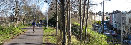
Many of the "new infrastructure" cycling routes proposed are not new at all but upgrades of existing routes, for example the current construction through St
Werburghs and the routes to
Henbury in south Bristol (the
Malago Greenway and
Whitchurch Railway Path already exist). Much of the "new infrastructure" is based on existing roads, like St Philip's Causeway (the Spine road), which is described in the text as "possible cycle access along the spine road...." Possible? that sounds a bit tentative. Have they thought this through?
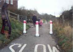
Other examples of "new infrastructure" have already been provided as a result of new developments (e.g. the Cheese Grater bridge (below) at Temple
Meads and the "new" links at
Carboot Circus) and owe nothing to Cycling City for
their existence. In fact both those examples replace previously existing infrastructure that was arguably better than what is now being provided. Some proposed "new infrastructure" to be provided as planning gain (like
Wapping Wharf) looks unlikely to materialise in the present economic climate.

And what about the glaring omissions? Where on the map is the Bristol & Bath Railway Path south of Mangotsfield? Where is the Chocolate Path and the link under Cumberland Road? Where is the Riverside Path through St Anne's? Where are the Sustrans National Cycle Network routes like NCN 4 between the centre and the Downs? Naturally I don't rate rush Sustrans routes, but neither it seems do the Council.
I'm astounded at the Council's mendacity (or is it sheer incompetence?) when it comes to the mapping. Do they think we are all map illiterate and won't be able to see how misleading and devious so much of what they show is? Even taking the map at face value there is no way that the so-called "new infrastructure" is going to lead to a doubling of cycling. The bulk of cycling takes place on ordinary roads, roads like
Cheltenham Road and Gloucester Road which have exceptionally high cycle flows and many reported problems for cyclists, yet these crucial roads are entirely ignored by the map.