
The case for the developers is very ably put, as is usual these days, by professional PR consultants. They argue that including some of the park in the development will allow a better quality development overall with more benefits to the public, in much the same way as Squarepeg argue for the inclusion of green space from the Railway Path in their Chocolate Factory development. There can be little doubt that in principle at least including areas of green space in developments allows for the more profitable elements to cross-subsidise less profitable or unprofitable elements that otherwise couldn't be included.
But that leaves some fundamental questions. Firstly should we trust the developers and Bristol City Council when they claim that they are incorporating the green space in question for the greater public good? Well the developers would say that, wouldn't they. But can we trust the Council not to 'go native' and increasingly see things from the developers' perspective? Once I would have been inclined to give the the Council the benefit of the doubt on that. But now, after the Council pushed so hard for turning the Railway Path into a bus route?

The second question is 'if developing green space is potentially to the greater public good, what is to stop every single piece of green space in the city being developed on the same basis? What's true for one acre of green space is equally true for 10 acres or 100 acres. Although we all feel that green space has some value, it is very hard to quantify it and therefore give it sufficient weight to protect it from development.
At the Chocolate Factory in Greenbank George Ferguson, acting for the developers, famously called the green space of the Railway Path embankment, including 150 metres of mature hedgerow, "completely pointless", but others have taken a different view. Likewise at Castle Park we find that the same ploy of proposing 'cycle house' on green space (the green bank shown above) alongside the cycle route may be used, following developer 'consultations' with Sustrans, who appear to be happy to accept the wholesale urbanisation of cycle paths.
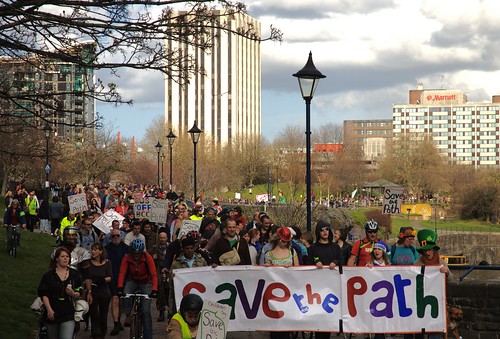
In the end the only protection for green space in the city will be ordinary citizens acting individually or collectively to assert the value of each piece of green space as it is threatened, as happened so spectacularly this year in relation to the Railway Path in east Bristol (above). Until such time as we can trust our own City Council to act in the interests of the public (which they manifestly failed to do with the bus route plan for the Railway Path) what other option is there but popular opposition to each and every proposal to develop green space?


12 comments:
Please note that the "FAQs" linked to above are from an old web page and refer to the 2006 proposal, which has since been substantially revised. The information on that page does not reflect Deeley Freed's current position. For an up to date summary of what is proposed for the St Mary le Port site (subject to the outcome of the Town Green public inquiry and further consultation) please visit the St Mary le Port website at www.stmaryleport.com
Thanks for that Spirit PR. There is already a link to the St Mary le Port site at the beginning of the post, but I'll change the link to the FAQs to avoid any confusion.
'In the end the only protection for green space in the city will be ordinary citizens acting individually or collectively to assert the value of the each piece of green space as it is threatened...'
Yes, I agree, though there are opportunities to act before threats become publicly known too. I intend to make the case for green spaces, in particular in my own area, Knowle. I urge people to get involved as much as they can in the drawing up of draft Area Green Space Plans in the coming months and in the consultation on those plans next year (probably in the Summer).
Unfortuneately, against people asserting the value of their green spaces we have powerful senior city council officers responsible for regeneration and 'development'. They currently have the power to determine that green spaces are of secondary importance with the sweep of a pen, following little or no broad-based consultation processes at all! 'Development' trumps green spaces policy, so we have our work cut out!
http://vowlesthegreen.blogspot.com/search/label/complaint
I've found the following on one of the links given.
"Over recent months George Ferguson, architect and past president of RIBA, together with conservation architect, Richard Pedlar, have been talking to some of the key interest groups to identify a shared vision and ‘sense of place’ for this site."
So they've called in George to work his usual magic and persuade us all that the loss of green space, or should that be 'completely pointless' space, is all to the good.
Ferguson was called in about 18 months as "consultant architect" when the project encountered serious PR problems and high-levels of public disquiet.
I think he was brought in as he was considered to have a lot influence in the wider community as well as other useful local contacts.
Deeley Freed have also changed their PR. It was originally the Avril Baker Consultancy.
That seems to be George Ferguson's modus operandi. High profile development proposals run into popular opposition (which may or may not include George and/or his mates). The developer casts around for a white knight to come and reconcile their aspirations with public concerns.
Along comes George who dresses the proposals up in a lot of urban buzz words - mixed use, vibrant street markets, green credentials, community focus, cycle docks, etc. - and away they go. I wonder how long his credibility can survive as more and more people cotton on.
The new PR people are Spirit PR who commented above. Interestingly the list of FAQs that I linked to originally and which they said only related to the 2006 proposals has now been taken down from the net by Spirit. I wish I'd made a copy of it.
I've heard claims at a recent public meeting that district councils now have to justify the value of the current use of all assets they hold, including open spaces, as part of an Asset Management Plan for audit. It is rumoured that this will be extended to town and village councils (the lowest tier) in the near future.
Where were the FAQs? Someone may have taken a copy, but some searches need the page address.
I found a copy of the FAQs cached on Google so here they are, but bear in mind that this relates to the 2006 proposals which are no longer current.
FAQ
Q1: How much of Castle Park are you planning to build over?
A1: The area which Deeley Freed have been selected by Bristol City Council and the other landowners to study and masterplan includes the rundown office blocks at St Mary le Port, the derelict area around the remains of St Mary le Port church, and the space up to and around St Peters church, about 18% of the total area of Castle Park. By no stretch of the imagination is all of the 18% intended to be buildings. Deeley Freed are at an early stage in developing a masterplan and the balance of buildings and public open space within the masterplan area is still to be agreed. Bristol City Council has not made any decision about the precise footprint of any scheme. However it is intended that any loss of green space on Castle Park will be mitigated through new high quality public open space within any development itself and also through funding of other improvements in the rest of Castle Park. These would be achieved through the “Section 106 Planning Agreement”, which is a legal commitment by the developer to make a financial contribution to offset the impact of a major development on the local area.
Q2: Why not just flatten the current buildings at St Mary le Port and extend the park?
A2: This is completely contrary to long-established council policy and it is difficult to see how it could be done without enormous cost to the council tax payer. It would involve Bristol City Council compensating other commercial organisations which own buildings on the site, funding demolition and re-landscaping, and supporting ongoing maintenance and management of new park land. In reality this is completely unviable.
Q3: Why can't the development be restricted to the current run-down office buildings at St Mary le Port and the surrounding land that is already hard surfaced?
A3: This is one of a number of options that we are considering and putting to the public as part of the current consultation. However, Bristol City Council and Deeley Freed's ambition is to secure a scheme that is significant enough to make a real difference to the area and not merely to put a sticking plaster on the current unsatisfactory environment. It is also important that the development secures significant investment for the rest of Castle Park through the 'Section 106' planning agreements that accompany it. There are strong urban design reasons why the masterplan area has been selected for detailed study. Any development should improve connections with the nearby Broadmead and Galleries areas, the old City and Redcliffe, unifying much of the heart of the city and creating better links between different commercial and retail locations.
Q4: How will the site act as a link between Broadmead shopping centre, the Old City and Harbourside, together with Redcliffe Wharf and Temple Quarter? Why do you need more buildings to do this – why can’t the existing park provide the link?
A4: Improving links between different parts of the city centre is a priority for Bristol City Council. This is not just about creating paths and walkways, but about creating uses that attract people and bring an area to life with improved life and vitality. Wine Street is already one of the busiest streets in Bristol. Any new development should aim to re-establish historic Mary Le Port Street, joining up the already vibrant Harbourside and Old City areas with the newly re-developed Broadmead to the north and Redcliffe and Temple Quarter to the south. A new route connecting Union Street across the Park to the proposed new footbridge and Redcliffe will also help draw new people into Castle Park.
Q5: Will other areas of Castle Park be used for further developments?
A5: It is incorrect to suggest that there are any plans or even thoughts about redeveloping the whole of Castle Park and some of the recent media coverage has been misleading in this respect
Q6: Where are office workers and locals going to be able to enjoy their lunch when the area they use has been built on?
A6: No decision has yet been made as to what exact areas will be built upon. Deeley Freed and Bristol City Council are very aware of the concerns of local residents and workers who use Castle Park at lunchtimes. One of the key aims of the development is to release new funds (see A1 above) for general improvements to Castle Park, parts of which are underused and in need of upgrading. Improved areas within the park will be designed to meet the needs of current users and attract more people to the Park.
Q7: How are you consulting the public?
A7: We are at an early stage in the process of developing a masterplan and both Bristol City Council and Deeley Freed are committed to full and open consultation on this scheme. Deeley Freed recently mounted a public exhibition in The Galleries in July to outline how they are approaching this work and some of the key principles which will guide their masterplan. The exhibition boards and a feedback form can be found on the ‘Consultation’ page of the project website. Alternatively, members of the public can contact Deeley Freed’s consultation consultant Avril Baker at info@abc-pr.com or (0117) 977 2002. There is also extensive on-going consultation with a wide range of amenity and specific-interest groups such as the Bristol Civic Society, Sustrans and English Heritage. Project updates will be posted on the St Mary le Port website including details and the results of ongoing environmental and site investigations. Deeley Freed will be holding a further exhibition in September to show how the team’s thinking has progressed and how they have responded to feedback. This will enable the public to view and give further feedback on the proposals once they have been more fully developed. The date for this exhibition will be publicised in advance on the project website, through the press and media, signs at St Mary le Port and local residents and businesses will be notified by letter. Deeley Freed are working towards agreeing their masterplan with Bristol City Council in and applying for planning permission in the winter.
Q8: What is going to happen to the churches?
A8: The masterplan will aim to enhance the settings of the remains of both St Mary le Port and St Peters Church, both of which will be retained. The intention is to provide a new public square around St Mary le Port, which is currently very run down and inaccessible, surrounded by ugly office blocks. The area around St Peter’s Church would also be improved and the developers are exploring the possibility of bringing it back into some kind of public use. The views of the historic churches at St Mary le Port and St Peters will be preserved.
Q9: Is St Mary le Port just going to be an extension of Broadmead?
A9: The intention is to provide a very limited amount of small scale shops, cafes and restaurants within the development, which will be let at affordable rents to enable local independent retailers to find a city centre base. They will be very different to the high street multiple retailers found in Broadmead but will be larger that those at the nearby St Nicholas Market, which they will be designed to complement. The idea will be to create the type of environment currently found around the very popular Borough Market area in South London or Seven Dials area around Covent Garden in London.
Q10: Why do you want to put housing into the development when there’s more being built at Temple Quay?
A10: The proposal is for a mixed-use development with a combination of residential accommodation providing surveillance over the Park which will help make it safer for people walking and cycling through the park. The housing will also help pay for improvements to Castle Park and enable the shop units within the development to be offered to local retailers and local café operators at affordable rents.
Q11: How much of the new housing will be affordable?
A11: The whole development will have an emphasis on high quality design which a site of this strategic importance needs, but up to 30% of the homes being proposed will be affordable housing in accordance with local planning policy.
Q12: What will happen as a result of the archaeological investigations currently taking place at St Mary le Port?
A12: The archaeological investigation works will ensure the fragile record of Bristol’s past is protected. The St Mary-le-Port area lay at the heart of the medieval town of Bristol and excavation in the 1960s showed that St Mary-le-Port church and the street where it stands, Mary-le-Port Street, were of late Saxon origin. The results of the archaeological investigations will ensure any development will
• Preserve sensitive areas
• Respects historic street patterns
• Preserves and enhances the setting of the vaults, St Mary le Port and St Peter’s churches
• Preserves nationally important archaeological remains
The archaeological report will be posted on the project website, when complete. Deeley Freed have extensive experience of commissioning archaeological works in central Bristol and are aware of the significant public interest in the long history of the ancient city. Deeley Freed recently held a public open day to view the archaeology ( an extensive Bristol glassworks ) that was revealed at its Portwall Lane excavation in central Bristol and around 700 members of the public attended that event. Deeley Freed intend to host a similar event before development gets underway at St Mary le Port.
Q13: Has an environmental impact assessment taken place? What about all the wildlife in the park?
A13: A range of assessments are being conducted, including a full environmental impact assessment, to identify the flora and fauna on the site and ensure the masterplan mitigates the impact of any development on their habitat. The results of the investigations will be posted on the project website, when complete.
Q14: When is the footbridge going to be built across to the former Courage Brewery site?
A14: The footbridge is going to be built by Mansur, the owners of the former Courage Brewery site, as part of their ‘Section 106’ agreement, to develop their site. It is understood that Mansur will be signing their Section 106 Planning Agreement shortly. Depending on construction timescales the footbridge could be open to coincide with the redevelopment of St Mary le Port
Q15: What will happen to the cycle link?
A15: Plans include the enhancement of the cycle link and the developers have consulted with Sustrans, the UK’s leading sustainable transport charity.
Q16: What will happen to the existing well-used footpaths on the site?
A16: This will be dependent on further research and consultation. It is anticipated that movement through the site for pedestrians, wheelchair users and cyclists will be improved.
Q17: Are you going to remove any of the mature trees on Castle Park?
A17: We are looking at a comprehensive landscaping and mature tree planting scheme for the area including the greening of Wine St, Mary le Port Square and the waterfront. Some trees are likely to be removed but overall the landscaping effect will be improved.
Q18: Is this going to be one of Bristol's showcase bus routes?
A18: It is not intended at this stage for this to be one of Bristol’s showcase bus routes
I hope the lessons of Packer's have been learnt.
"You will need to show on a map the area you wish to register and the locality or neighbourhood in which those using the green ‘as of right’.
You will need to show that a significant number of those people who use the land are local people."
http://www.oss.org.uk/village%20greens/villagegreens.htm
Delighted to find that Warneford Meadows won in Oxford:
"Paul's barrister, Ross Crail, put forward a lucid and persuasive case to demonstrate that for more than twenty years many local residents have freely used Warneford Meadow and Orchard for recreation and pastimes. The NHS denied this and argued that the recreational use was only sporadic and that the meadow’s main use is for commuters and local residents who only use the footpaths to go to and from the hospital, university and amenities in Headington and Cowley."
http://www.friendsofwarnefordmeadow.org.uk/page.php?pageid=green
“It has shown what a strong sense of community exists in the Warneford Meadow neighbourhood that so much has been achieved.”
"... drawn-out process meant that the legal costs trebled since the original estimates to reach a total of £45,000."
“Planning has become a dangerous, bureaucratic minefield. It is said that there are only three people left in England who are capable of understanding it: one died young; one fled the country; and the other expert has now gone completely mad." This mad expert now seems to be in charge of the applications to develop Warneford Meadow. The papers to be considered by Oxford City's main planning committee tomorrow are as strange as they come. The Meadow, they suggest, might be used for key worker housing, student accommodation, medical research, administration or academic use… they only forgot to add housing for refugees from Mars” … or cycle houses, perhaps?
http://www.friendsofwarnefordmeadow.org.uk/page.php?pageid=recent
Britain seems to be trapped in a vicious development cycle of increasing social complexity -> increasing demand -> increasing bureaucracy -> increasing cost -> increasing development ->
There is a simple way out of all this, but are people willing to take it?
I remember asking at a briefing who would decide which green space gets sold off and which gets retained, It will be a group of officers.
Decision making has formally gone from councillors down in to officer world, based on the criteria used in the strategy.
I also seem to remember being told that the order in which plans would be drawn up would be done on the basis of where most space might be 'up-for-developer-grabs'
CHarlie Bolton
It might help if you reverted to using the proper name: Castle Green
I thought about that, but noted that the web site of those applying for the Town Green designation calls it Castle Park so thought it best to follow suit.
Post a Comment